
WALK IN THE MENHIRS LAND - SAINT-ETIENNE-DU-VALDONNEZ

Foot
WALK IN THE MENHIRS LAND
parking des menhirs
-
48000 SAINT-ETIENNE-DU-VALDONNEZ
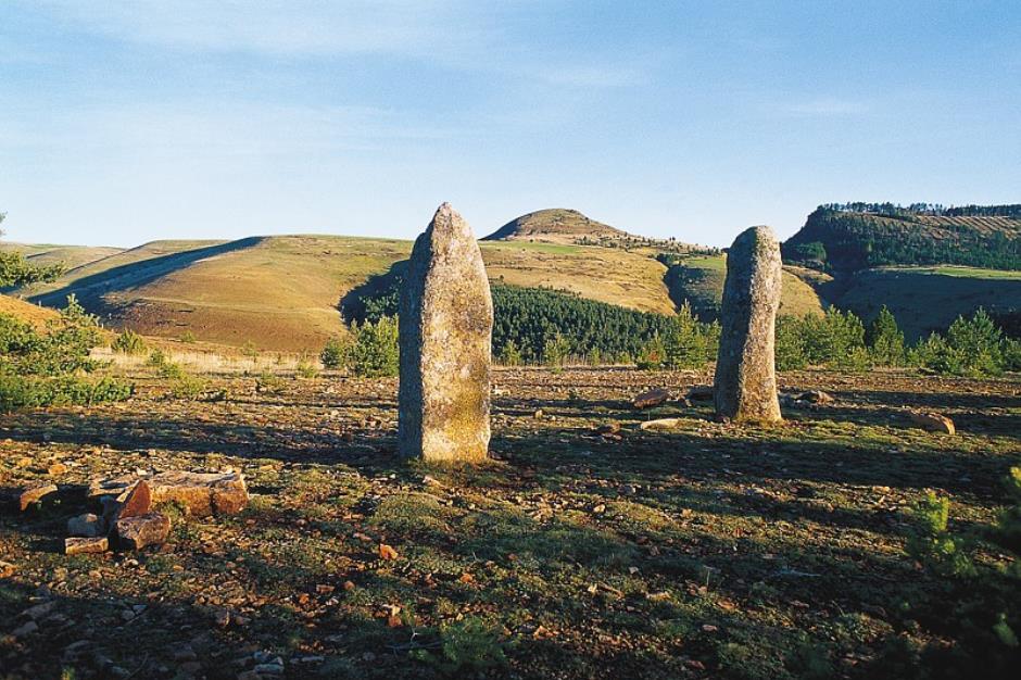
5,000 years ago, human groups settled and marked the landscape of the Bondons' Cham by erecting megaliths, imposing stone monuments. With nearly 200 standing stones known to date, this site is one of the largest concentrations of menhirs in France. 5 km long, the trail reveals some of these monuments and offers a magnificent panorama of the Causses. A walk to discover megalithism, one of the most mysterious phenomena of the late Neolithic.
Reception
Min height : 996 m
Max height : 1180 m
Natural regions : Mont Lozere
Territories : National Park of the Cevennes
Reservation
Itinerary
Beacon : Interpretive Trail
Level : Very Easy
Distance : 5.4459 km
Duration in hours : 02:00 h
Negative difference : 204 m
Positive difference : 204 m
Loop itinerary : yes
1. From LES BONDONS - D 35 à 4 km du col de Montmirat to LES BONDONS - D 35 à 4 km du col de Montmirat
Distance : 5Km
Duration : 02:00


Information updated on 15/04/24 / Report an error on this offer !